
From the Cooney Archives: This Day in History on August 6, 1781
On August 6, 1781, a war party of sixty or more Indigenous Indians and Tories, accompanied by the Loyalist McDonald, struck the Schell settlement northwest of Little Falls.

On August 6, 1781, a war party of sixty or more Indigenous Indians and Tories, accompanied by the Loyalist McDonald, struck the Schell settlement northwest of Little Falls.
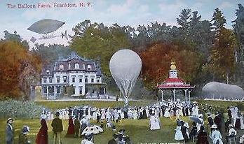
On July 4, 1880, a crowd of 15,000 gathered in Little Falls to watch the maiden flight of balloonist Mary Hawley.
On June 28, 1878, Authorities are enforcing the law regarding cattle running in the village streets. It is hoped that property owners will take down cattle fences in front of their homes and put in beautiful lawns to beautify our streets.
On May 29, 1827, An attempt by Judge Sanders Lansing, who represented the Ellice Estate, to write a second charter in 1826 was aborted.
On May 2, 1897, a council of the Knights of Columbus was organized in the old Gymnasium Hall in the McCauley Building in Little Falls.
On April 6, 1903, the South Side Athletic Club has been reorganized with Frank O’Hara as manager. The club is negotiating for ball grounds on the north side between Little Falls and Herkimer that can be reached by trolley.
On March 1, 1896, The hospital, formerly located on North Ann Street, was moved to larger quarters at the Ackerman property at 610 West Monroe Street. Future plans call for the erection of a new building once the hospital association is in shape fiscally.

From the Cooney Archives: THIS DAY IN HISTORY: Did you know … that on February 18, 1926, Johan Ditlev Frederiksen, cheese industry icon, inventor, author, and manager of the Chr. Hansen’s Laboratory in Little Falls and died in Florida? Born and educated in Denmark, Mr. Frederiksen came to Little Falls in 1879. He was very active in the community and helped establish the Pine Crest tuberculosis sanatorium in Salisbury. He will be buried in Church Street Cemetery.”
On February 14, 1937, the Old Bakery Oven found as Bellinger Block is razed on North Ann Street. Chief Cooney’s scrapbooks indicate it was in use 70 years ago, when A E Bellinger operated a bakery here.
On December 1, 1853, John Burnham was attempted to cross the aqueduct on the side without rails, slipped on the ice, and fell 20 or 25 feet to his death upon the rocks below.
 42 North Ann Street | Chapman-Moser Funeral Home
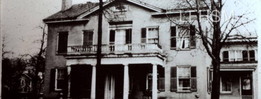
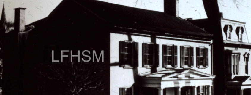 1826 Viskup - Lansing House | 22 Church Street
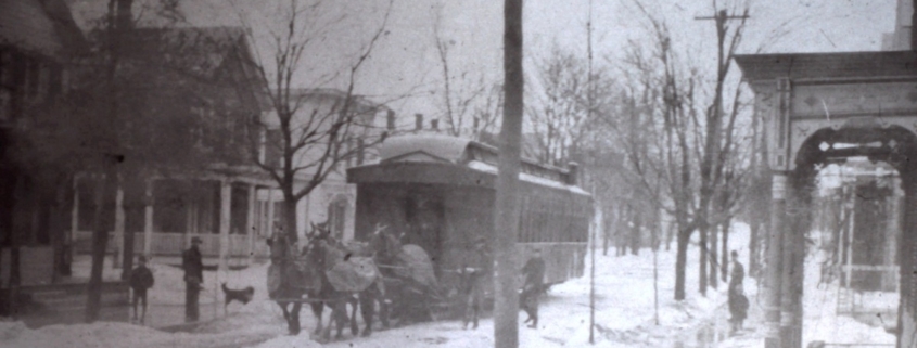 Circa 1914 | Street Car being pulled by horses on Main Street, Dolgeville, New York. Courtesy of the Little Falls Historical Society.
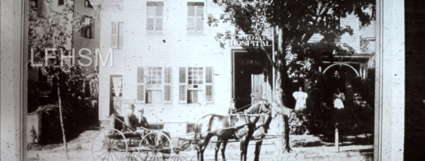 14 North Ann Street | First Hospital at Little Falls, New York | Established 1893 | Dr. Eveleth holding is the horse's reins.
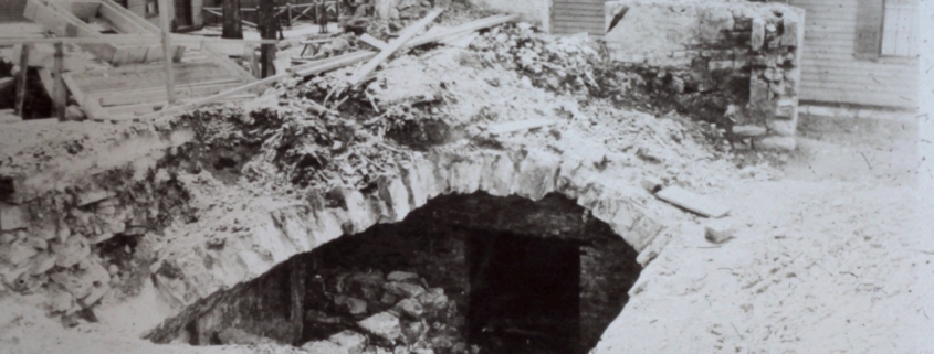 Bakery Oven at 4 North Ann Street, Little Falls, New York
 Circa 1824 | Jaques Gerad Milbert "Aqueduct Bridge"