The Little Falls Historical Society Museum

Little Falls Waterways

The Little Falls Historical Society 2017 exhibit focused on the bicentennial of the groundbreaking of the Erie Canal and the evolution of our waterways and on the history of music in Little Falls.

Little Falls Waterways Writing Series

Click on the author and title below to read the writing series articles.

Over the past two centuries the waterways of Little Falls have undergone major alterations. A Palatine settler or an Iroquois brave from the early days of the village’s existence would find the landscape alien, as conversely would a person from the present day transported back to that time. To realize how drastic those changes have been, one must follow the course of those transformations.

Over the past two centuries the waterways of Little Falls have undergone major alterations. A Palatine settler or an Iroquois brave from the early days of the village’s existence would find the landscape alien, as conversely would a person from the present day transported back to that time. To realize how drastic those changes have been, one must follow the course of those transformations.

Like most small rivers, the relatively placid Mohawk was complete with small islands, sand bars, deeper holes and jutting points. As it entered the Little Falls stretch, it flowed around a small, barren island which rose just above the waterline. Washed nearly clean of vegetation by frequent rain or snow melt induced flooding, the outcropping would first be named Lock Island and then Hansen Island. From this point the current picked up and surged as the elevation of the river bed dropped 40 feet in less than a mile.

A mid-19th century writer gave a most picturesque description of the rapids, he wrote that the river in Little Falls “goes dashing and bubbling, leaping and tumbling, from rock to rock through the narrow gorge which seems to have been cut expressly for its passage by artificial means.” The rapids smoothed out as the river flowed around a large island, variously known as Rosecrantz Island, Drummond Island and, finally, Seeley Island.

As the river exited the Little Falls section it passed over a very deep hole, of 60 feet or more, and flowed by a large rock outcropping (the northern face of Moss Island) before continuing its eastern journey.

The terrain on the north side of the river was originally must as it is today. From the river’s edge stretched an expanse of flat floodplain. The landscape then abruptly changed to step-like terraces, demarcating past river levels. Beyond rose the northern walls of the Mohawk Valley. From these hillsides a number of small streams (long since routed underground) emptied into the river.

The topography on the southern side of the river was much different than it was on the northern shore. On the upstream (western) end of the rapids, flat “bottom land” mirrored the north side, but as the valley narrowed it gave way to steep rock walls interspersed with massive gneiss outcroppings. At the eastern terminus of the rapids the river was squeezed by a Gibraltar-like mass 40 feet above the water. This feature, complete with circular potholes and the profile of a hatchet-faced man, would become Moss Island. Looming above all of this stone was the precipitous northern face of Fall Hill.

To eliminate the vagaries of the Mohawk River – current, rapids, shallows – the Erie was dug on the south side of the river on a basically parallel route with it. (An earlier canal opened in 1795, the Western Inland Lock, which ran along the north side of the river, was short lived.) Opened in 1825, the Erie was four feet deep and 40 feet wide and was, except for feeder channels, totally divorced from the Mohawk River. The Erie Canal entered Little Falls from the west in what is now the median between Flint Avenue and the highway leading to Route 5S (Route 167). Near the present day guard gates, it jogged slightly to the north then back eastward. At this point it began to descend the 40-foot drop in elevation by means of three locks until it continued on along the course of what is now the road to the Thruway interchange (Route 169). With the Mohawk River on one side and the Erie Canal on the other, Moss Island was born.

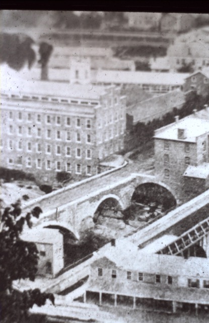
In 1841 the Erie Canal was widened and deepened to accommodate increased traffic. The southern channel of the river that swept by Seeley Island was filled in at both ends and incorporated into the “enlarged” Erie. Seeley Island, now existing as an island in name only, was physically joined with the newly formed Moss Island. Feeder channels, which ran from the river to the canal, sliced off another piece of land, which was dubbed Loomis Island. Later, when these feeder channels were filled in, Loomis, Seeley and Moss Islands were combined to form a “super island.” By the mid-1800s there were over 50 buildings located there. Mills, grocery stores, boarding houses, hotels, liveries, slaughterhouses and private residences either catered to canal traffic or made use of the abundant waterpower available.

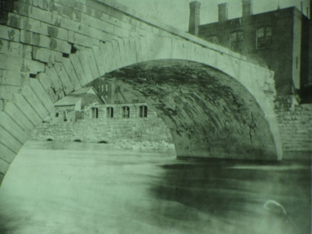
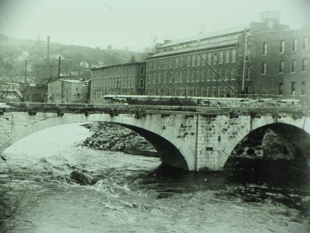
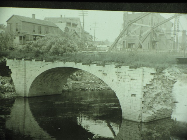
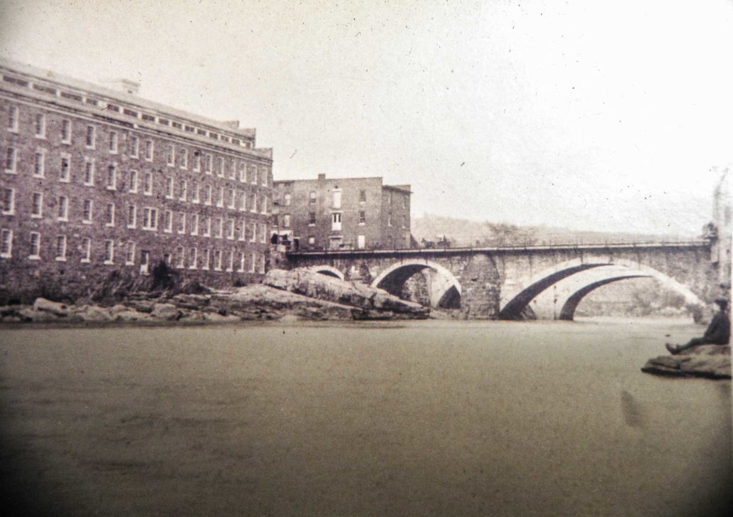
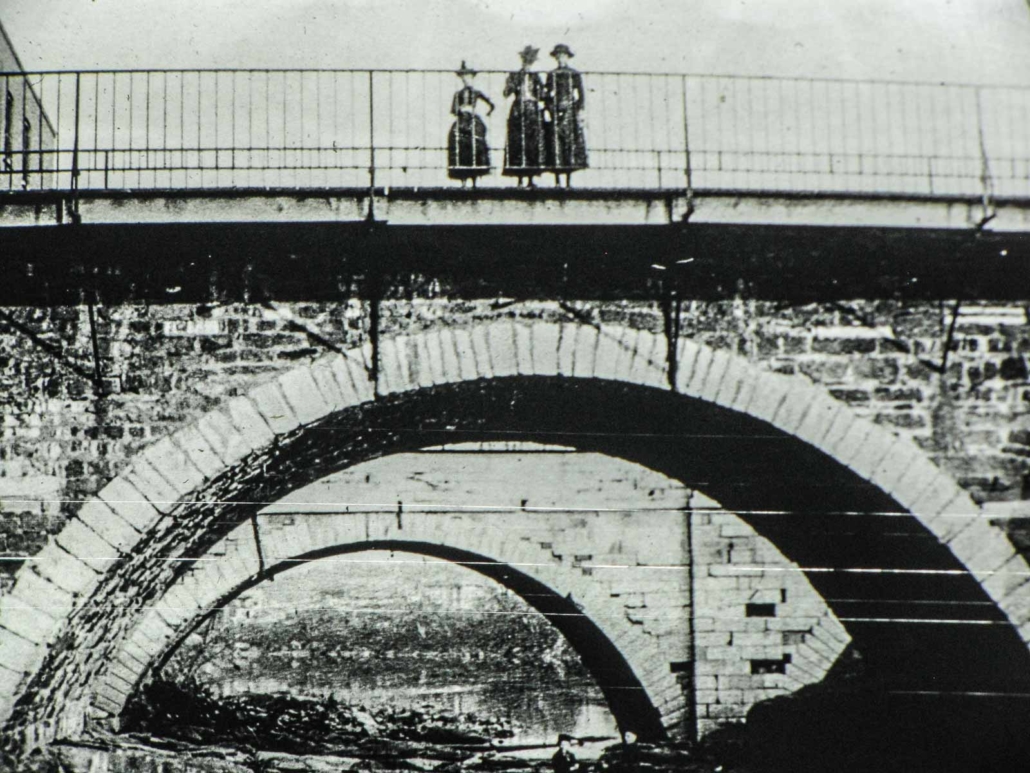
Further improvements in the following years – an aqueduct that brought canal traffic and better accessibility to more village businesses to a boat basin on the north side of the river, bridges over the canal at Bellinger Street and opposite Lock Island, and wing dams in the river to provide waterpower – also contributed to the changing landscape of the south side of Little Falls.

At the beginning of the 20th century, as the size of freight boats increased and technology replaced the horse and mule as means of locomotion, the need for a much larger canal was again evident. In many locations the footprint of the Erie Canal was enlarged and brought into existence as the new Barge Canal, but in the Little Falls area the Mohawk River served the purpose. The Mohawk River east and west of Little Falls was deepened to at least 14 feet and straightened (islands were dredged out and points of land jutting out into the river were sliced off.) In Little Falls a whole new river/canal channel was dug south of Lock Island, concrete walls were poured, a massive double door guard gate was erected and Lock 17 was built replacing the four Erie Canal locks. Completed in 1918, the Barge Canal lopped off much of Loomis/Seeley/Moss Island displacing many of the buildings on the island. Also, Goat Island was created by the heightened water level. The final product looked much as it does today.

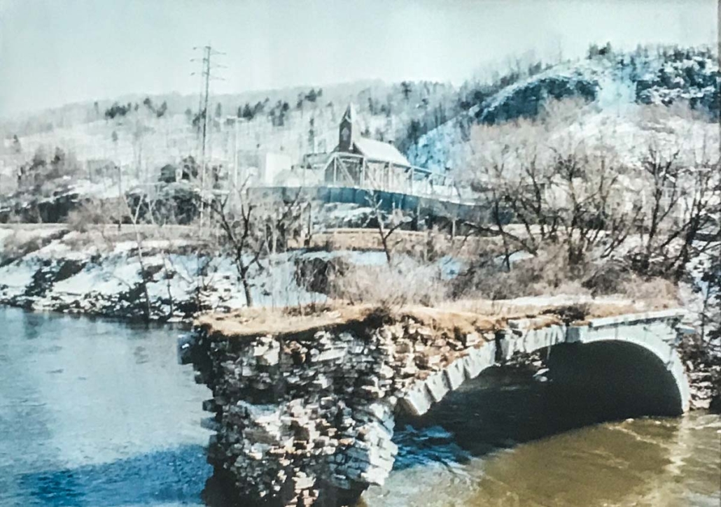
Remnants of the waterways and geography of southern Little Falls remain. The rapids of the Mohawk River, along with ruins of wing dams and waterpower flumes, can be viewed from the Ann Street Bridge. The Western Island guard lock adjacent to Hansen’s Island and Lock 36 of the Erie Canal (just below Lock 17) and a portion of the Erie’s Lock 38 (encased in a wall below Burke Bridge) are well known. And the bed of the Erie Canal can be seen just off Route 167 southwest of the city. But most evident are the ancient rock outcroppings that once stretched from Moss Island across the span of what is now the Barge Canal (once again renamed the Erie Canal in 1992) to the foot of Fall Hill’s cliffs.

The Little Falls Historical Society 2017 exhibits will focus on the bicentennial of the groundbreaking of the Erie Canal and the evolution of our waterways and on the history of music in Little Falls. The museum opens for the season with a reception on May 23.

Editor’s note: David Krutz’s article, “Evolution of the Little Falls,” is the first part of the Little Falls Historical Society’s 2017 writing series. Other articles will follow up until and following the opening of the historical society museum on May 23. Article topics will vary, but each will relate either to the bicentennial of the 1817 groundbreaking for the Erie Canal or to the history of music in Little Falls.

The Erie Canal opened in 1825 when our nation was not yet 50 years old. Opportunities for the natives and immigrants abounded not only from the building of the canal, but also in the need for the conveyance of people and freight along it.

Driving mules on the Erie Canal appealed to loners, orphans and runaways. President James Garfield and many other successful men began their work careers as a mule driver. The mule driver, or “hoggee,” a Scottish term, very often was a 10- to 16-year-old boy, or an older, unmarried man. A round trip on the canal would take about 30 days and a driver could potentially make seven of these trips in a season.

The job of a mule driver was harsh, tiresome and dangerous at times. Six hour shifts, day or night, rain or snow, hot or cold, the towing continued until a lock or a change bridge – where the towpath often changed sides of the canal – was met.

The drivers walked 10 to 12 miles a day, from May until November. They would sleep as much as they could between shifts. Some off hours were spent repairing the lines, harnesses, or other equipment on board the canal boat. The “hoggee” would rise an hour before the shift started to feed himself and the mules. Water for the animals came from the canal. Horses would drink putrid water; mules would not, one reason for using mules. While most walked behind the mules, sometimes, a boy was legally allowed to ride. One unfortunate, very drowsy, young man was riding a cart, toppled into the canal with the cart on top of him and drowned. The mules survived.

One 19-year-old driver died when struck by the broken whippletree portion of the mule harness. Another “hoggee” had his hand mangled by a boat hook. A 16-year-old boy from Little Falls, Charles B. Barse, was struck and killed by lightning near Rochester while driving mules along the towpath.

Mules were generally believed to have the best traits of both the donkey and the horse. They are smart, strong and sure-footed. Occasionally, there were accidents that took the mules’ lives, especially on the enlarged Erie. In 1904, close to Little Falls, a tow line caught and pulled three mules into the canal. They belonged to a Captain Egan, of Syracuse. Two of the mules were saved, but one was drowned. In another accident, in October 1909, three mules jumped into the canal after being frightened by an auto. Two of the animals drowned.

Some mules were wintered by farmers who were paid a dollar a week per animal. Most took good care of the mules. Some underfed them until the spring and then overfed them to fatten them up for the opening of the canal. The mistreatment of mules was noticed by the SPCA who sent inspectors to the canal stables. They would order the animals taken out of service until their galls (sore spots) were cared for. Interestingly, this action was taken before the National Child Labor Commission was established in 1904 which began to look into child workers.

There were two spots along the canal that some drivers called haunted. One was an old house near Montezuma where a murder had taken place. A team of mules once stopped there and would not continue along the towpath. The concerned driver walked ahead and found a piece of tarpaper from a decrepit house in the way. That is why the mules had balked. Another supposedly haunted place was east of Syracuse and there were also cemeteries along the canal that some drivers would prefer to get onboard the boat as they were passed.

“Hoggees” were known to walk around the farms surrounding a lock. Vegetables, fruits and sometimes a chicken would be “appropriated” and taken back to the boat. Farmers would discover the thefts and fire some warning shots in the air. Usually, the canal rumor mill sent the message up and down the waterway and the farmer’s garden and livestock would be left alone in the future.

When the trip was over, the drivers would be paid. They could make $70 to $100 per trip. Some saved money for the winter months, others “went to see the elephant,” a 19th century phrase that meant they saw all the sights of a town, including the shadier parts. Often large fights would break out as a result of this drinking and carousing. Sometimes villagers would covet a barge’s load, purposely get the captain and crewmembers drunk and then steal the goods. Many times members stole from each other’s trunks.

If a driver had a home, they would spend the winter there. Others would seek lodging in a hotel and work odd jobs until the canal opened and work began.

By 1916, the Barge Canal was opened in places and mules could only be used where the towpath still existed. By 1917, tugs had replaced the mules and new mechanical engines were employed throughout the entire canal system.

Editor’s Note: Patricia Stock’s article “Along the Towpath” is the second part of the Little Falls Historical Society’s 2017 writing series. Other articles will follow up until and following the opening of the historical society museum on May 23. Article topics will vary, but each will relate to the bicentennial of the 1817 groundbreaking for the Erie Canal or to the history of music in Little Falls.

Growing up on Seeley Island in Little Falls

Over the years, my mother Jane Prestopnik Miosek, shared photographs and tales about growing up in Little Falls on Seeley Island. This is her story.

“Bordered by the Mohawk River on the north and the Erie Canal (New York State Barge Canal) on the south was Seeley Island. Its unpaved streets were lined by identical two-story brown slated homes (owned by the Gilbert Knitting Mill) which provided housing for mill workers and their families. Rent was paid to Mr. Gilbert, owner of the knitting mill. I lived at 10 Seeley Island with my parents, Jacob and Catherine Prestopnik, my brothers, Jake, Frank and John, and my sisters, Kate and Frances. Later, my mother’s brother, Tony Lapajne, came to live with us.”

According to the 1930 federal census, rent for the 10 Seeley Island house was $15 per month ($215.12 in 2017 dollars). Jane’s family reported not owning a radio. Such a piece of equipment was “hi-tech” in 1930, so ownership of a radio came to be a separate question on the census form. Jane was seven years old in 1930. Her father’s occupation was listed as a “cotton baler.”

“I shared a bedroom and a bed on the second floor with my sister Frances. The dining room, living room, my parents’ bedroom, kitchen and a small room with only a toilet were on the ground floor. Bathing (sponge baths) was done in a wash tub or bucket by the kitchen stove as there was no regular bath tub. We had running water and the house was heated by burning wood or coal. As we walked along the railroad tracks, bits and pieces of coal that had fallen from passing rail cars were gathered up and taken home to be used in our stove. Refrigeration was provided by a chunk of ice placed in a wooden box (the ice-box). The ice never seemed to last very long. Laundry was done by hand using a scrub-board placed in a tub. Wringers were used to remove excess water. Depending on the weather, clothes were either hung inside the house or outside on a clothesline to dry. In the backyard a vegetable garden provided fresh produce in the spring and summer months.

“Life on the canal was colorful and hectic. Dandelion wine made by locals drove the men ‘crazy.’ Fights would break out and sometimes my mother would have to intervene to stop the fighting. Just about every day there would be two or three barges tied up waiting to go through Lock 17. Specially equipped barges carried fuel oil. Tug boats pulled flat bottomed boats which carried various grains.

“Goat Island was located in the middle of the Erie Canal just west of Lock 17. The outcropping of land was rocky and irregular and no one lived there. As children, we would swim in the canal and climb all over Goat Island to play and explore. It was here that I learned to swim, taught by my brothers and some friends. While swimming, watching out for passing boats was an adventure.

“The Slovenian-owned Seeley Island Club provided sandwiches, cookies, candy and a pool table for the boat crews. Sometimes, entire families lived on Erie Canal tug boats. The club provided a much welcomed break from the cramped quarters on canal boats.

“Our group of neighborhood kids (boys and girls, five to eight years old) would sometimes beg passing boat crews for money. They would throw us pennies and sometimes nickels. I can still remember how sometimes boat men would mischievously heat the coins before throwing them, thereby singeing our hands, much to their delight! Other times, they would throw coins into puddles in the road after heavy rains. We were quite a sight, splattered by muddy water as we excitedly searched for coins in the muddy water. We called those who did not toss us coins ‘flat tire pocket books.’

“My siblings and I all attended St. Mary’s Academy and our family walked everywhere as we did not have a car, although my parents did have bicycles.

“I do not remember the year when my father became ill with tuberculosis, it was a difficult time. When his health allowed, he would work at the Gilbert Knitting Mill. When he was well enough, my father would hunt and fish. Eventually, my father ended up spending a few years at Pinecrest Sanatorium in Salisbury. In his absence, my mother cared for the family. She was able to earn extra income by bringing home unfinished slippers from the Little Falls Shoe Company that she then stitched by hand. On Sunday, April 26, 1931, my father died in our Seeley Island home. He was 50 years old.

“Once Mr. Gilbert sold his knitting mills, everyone moved off Seeley Island. The homes and other buildings are now long gone. Only my memories remain.”

———

Mary Ann Miosek Murphy is a Little Falls native and frequent visitor to her hometown. Mary Ann and her husband, Bryan, are members of the Little Falls Historical Society.

Seeley and Hanson

40 feet

Moss Island

Hatchet Faced Man

Erie Canal

40 feet wide by 4 feet deep

Feeder Channels

Hanson Island

Aqueduct

Taylor Driving Park

Titus Sheard

A Mule Driver

10 to 12 miles

Tug Boats

Lock 17

$15.00 per month 

Coal

Coins